
The History and Evolution of Samaná Province
Samaná is a province located in the northeastern part of the country. Its name is derived from the indigenous name for the region; during the era of Conquest and Colonization, it was commonly written as Xamaná.
Creation of the Province
Samaná was the sixth province created in the country, alongside Puerto Plata. It was established by the Constitution of November 14, 1865, as a Maritime District—a territorial division of that era that differed from provinces in name only. The Constitution of 1907 (effective in 1908) eliminated the Maritime District category, officially designating Samaná as a province.
Early History and Colonial Conflict
-
1493: Christopher Columbus visited the territory in January during his first voyage to the Americas. At that time, Samaná was occupied by the Ciguayo people, and the first hostile encounter between Europeans and natives took place here.
-
16th – 18th Centuries: The region remained largely uninhabited, home only to a few escaped slaves (cimarrones) and European settlers. English and especially French sailors frequented the area.
-
“Carenero”: The beaches were used to repair and clean (carenar) the hulls of English and French ships, as well as those belonging to buccaneers and pirates. To this day, “Carenero” remains a common place name in Samaná.
-
Spanish Defense: Spanish colonial authorities launched periodic expeditions to evict the French. At one point, they maintained two galleys at Cayo Galeras, facing what is now the town of Las Galeras.
The Founding of Santa Bárbara
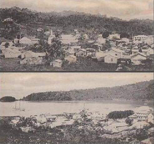
In 1756, the city of Santa Bárbara de Samaná was founded at a site called Carenero Grande by families from the Canary Islands. The settlement was organized as a Parish of the District of La Vega.
French and Haitian Influence
-
French Rule: When Spanish Santo Domingo passed to French control via the Treaty of Basel, Governor Ferrand encouraged French colonists fleeing the revolution in Haiti to settle in Samaná. They focused on coffee cultivation and the export of precious woods.
-
Linguistic Legacy: Many local names originate from these families or French words, such as Tesón (Tessón), Anadel (Arrendel), Clará (Clarac), and Las Terrenas (La terrienne, meaning “the landlady”).
-
-
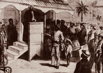
Haitian Occupation (1822–1844): President Boyer built forts in Los Cacaos and El Limón to control the bay. He settled Haitian families in Tesón and brought approximately 200 formerly enslaved African Americans to the region; those who stayed preserved their language and traditions.
Territorial Changes
The borders of Samaná have shifted significantly throughout history:
-
1844–1861: During the First Republic, Samaná was a municipality (Común) of El Seibo Province.
-
1865: Regained status as a Maritime District.
-
1907: Officially became a Province.
-
Modern Reductions: Originally, the province covered both sides of the Samaná Bay and extended along the coast to Cabrera. However, in 1958, the creation of the Julia Molina province (now María Trinidad Sánchez) stripped Samaná of most of its territory. The final reduction occurred in 1959 when Agua Santa del Yuna was transferred to the Duarte Province.


